
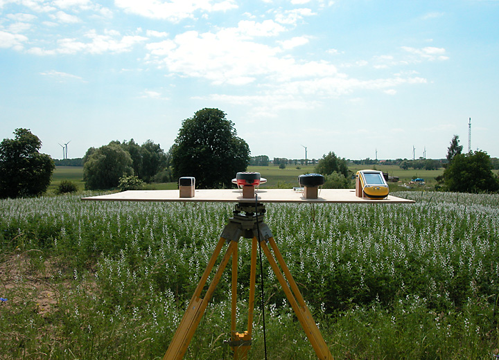
Feld 2006-06-14
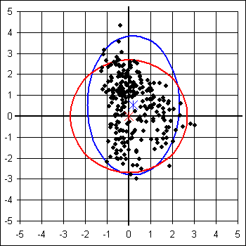
Garmin eTrex Legend
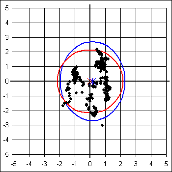
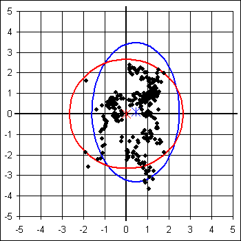
Leica GS20 AT501
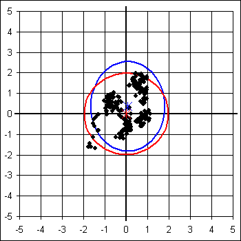
Trimble GeoXT
Leica GS20
Magellan MobileMapper CE
| Garmin eTrex Legend | Leica GS20 | Leica GS20 AT501 | Magellan MM CE | Trimble GeoXT | |
|---|---|---|---|---|---|
| Systematische Abw Ostwert | 0,196 m | 0,441 m | 0,158 m | 0,056 m | 0,074 m |
| Systematische Abw Nordwert | 0,529 m | 0,090 m | 0,012 m | 0,251 m | 0,368 m |
| Systematische Abw Höhe | -3,738 m | 0,286 m | 0,766 m | 0,619 m | 1,594 m |
| Systematische Abw Horizontal | 0,564 m | 0,450 m | 0,158 m | 0,257 m | 0,375 m |
| Standardabw Ostwert 95% | 2,112 m | 2,052 m | 2,126 m | 1,662 m | 1,733 m |
| Standardabw Nordwert 95% | 3,327 m | 3,396 m | 2,692 m | 1,801 m | 2,182 m |
| Standardabw Höhe 95% | 7,100 m | 6,760 m | 5,436 m | 4,216 m | 5,422 m |
| Standardabw Horizontal 95% | 2,785 m | 2,804 m | 2,424 m | 1,732 m | 1,969 m |
| Quantil Horizontal 95% | 2,690 m | 2,666 m | 2,162 m | 1,612 m | 1,977 m |
| Faktor Nordwert : Ostwert | 1,575 | 1,655 | 1,266 | 1,084 | 1,259 |
| Faktor Höhe : Horizontal | 2,550 | 2,411 | 2,242 | 2,434 | 2,753 |
Hier kann die Auswertung der Messergebnisse mit Microsoft Excel 2007 heruntergeladen werden:
2006-06-14_feld.zip (1,0 MB)